Course Manager

Course Manager - Overview

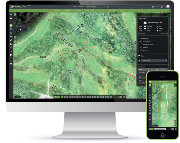
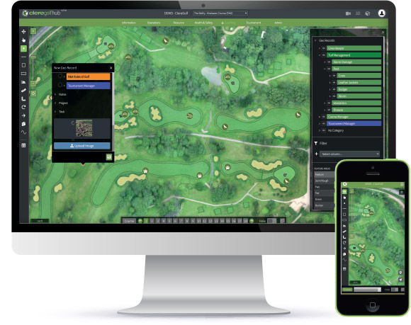
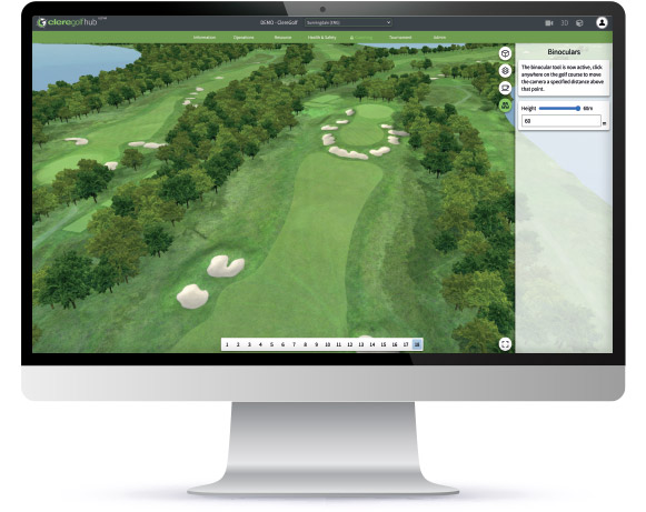
Designed with total visibility in mind. Our Course Manager module enables the precise location and nature of all on-course activity, past, present and future, to be captured with photographic evidence for analysis anytime, anywhere.

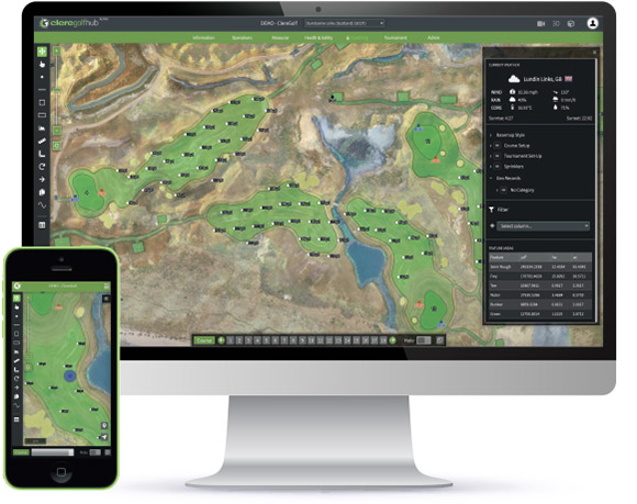
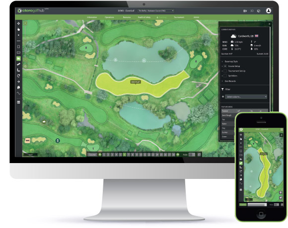
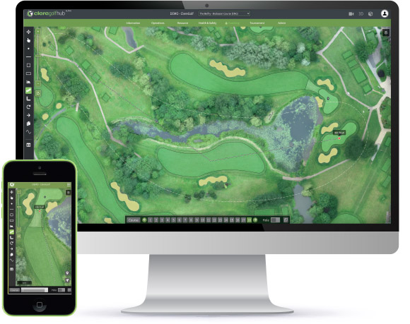
  • Interact with a present-day sub metre photographic survey of your golf course
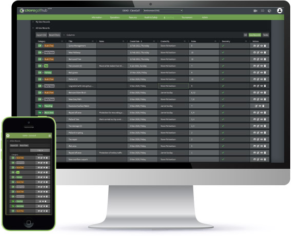
  • Use ‘geo-tags’’ to categorise incidents of damage, disease or planned works
  • Build a spatial (visual) record of those incidents for more insightful analysis
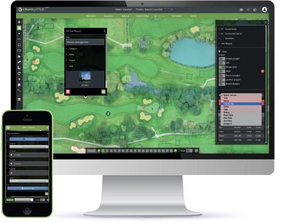
  • Ensure critical information is recorded, stored and passed on to others as your team evolves
  • Assign tasks with specific instructions and photographic evidence
  • Create your own categories and record data that is vital to you (stimp, firmness, moisture, pH, pest, disease etc.)
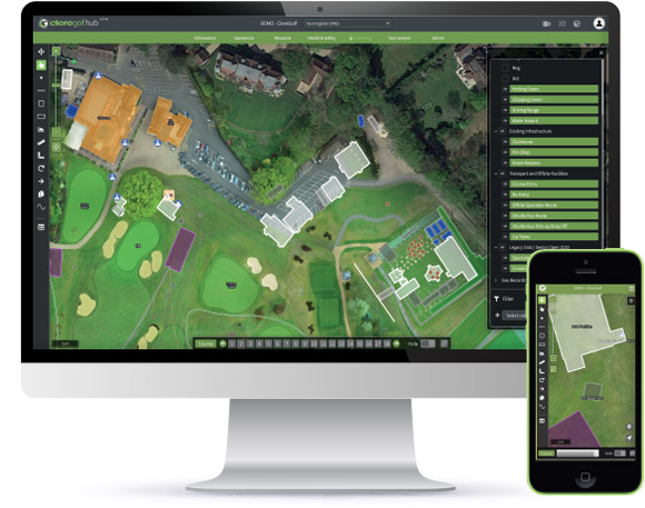
  • View all as-built plans in a single location anytime. Irrigation, Sub Air, Comms
  • Use the mobile App to record tasks and incidents whilst on-course
  • Revisit precise locations of ‘tagged’ incidents or features using the mobile App
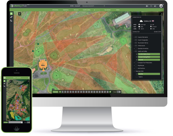
  • Upgrade to ClereGolf Enhance® GPS Device for sub metre on-course accuracy
Course Manager

'Above & Below' Plans

  • Often historical pipework and below ground plans are hard to find and difficult to access. Through our course manager everything can be stored geo-spataially against a present-day aerial image for easy access anytime, anywhere:
  • Irrigation systems can be GPS mapped or uploaded from 'as-built' plans and stored in 'layers' for the users to tailor their view
  • All information can be viewed on your GPS enabled mobile device allowing users to easily locate any component while on-course (just like a satellite navigation system)
  • Think of the HUB as a blank canvas on to which a host of data can be placed from pipework, gas and electricity, sub air systems, property boundaries....
  • Excavate in confidence knowing the precise location of any services below ground by knowing your location and that of any pipework
Course Manager
Course Manager
Course Manager

Sprinkler Systems

  • As new sprinkler systems are installed or existing systems updated or extended, it's vital to maintain an up-to-date record of what has been installed where. Through the HUB you can record the precise location of each sprinkler with ease and accompany each 'geo-record' with notes that can be stored, shared and reviewed:
  • Maintain an up-to-date record of all sprinkler heads including it's GPS location, manufacturer and head type
  • Use your GPS enabled device to locate hard to find sprinkler heads when on the course
  • Know the precise distance from every sprinkler to the front/middle/back of every green. Ideal when ordering and installing distance tags
  • With A4 and A3 'long hole view' print capabilities you can take hard hole layouts on-course for manual checks or use your GPS device when carrying out routine maintenance
Course Manager
Course Manager

Feature Analysis at your fingertips

Integral to the HUB is an incredibly accurate present-day aerial image captured of your course during our on-site survey. Upon processing this image our skilfull in-house team carefully outline each and every feature on all holes allowing you to:

  • Select any feature such as a tee, green fairway or bunker and know it's exact surface area
  • Move through the course in a 'hole-by-hole view' and see the summary of feature areas for that hole
  • Ensure 'seeds and feeds' are purchased efficiently by basing your orders on precise measurements
  • Apply application rates of chemicals with confidence in the knowledge that concentration levels are optimised
Course Manager
Course Manager
Course Manager

Remote Measuring & Planning

With sub 10cm accuracy across your entire course at your finger tips from any web enabled desktop or mobile device you can measure distance and area from home or office as precisely as you could on the course.

  • Accurately plan new tee or bunker construction by creating the features inside the HUB before measuring hole lengths, and driving distances to / from them.
  • Maintain an up-to-date record of all sprinkler heads including it's GPS location, manufacturer and head type
  • Use your GPS enabled device to locate hard to find sprinkler heads when on the course
  • Know the precise distance from every sprinkler to the front/middle/back of every green. Ideal when ordering and installing distance tags
  • With A4 and A3 'long hole view' print capabilities you can take hard hole layouts on-course for manual checks or use your GPS device when carrying out routine maintenance.
Course Manager
Course Manager

Geo Records

The golfHUB really comes into it's own with the ability to create geo-records (a record that is stored against a specific location), these records can be viewed against the map and navigated to using your GPS enabled device as you would with a satellite navigation system so that you can:

  • Capture photographic evidence of incidents such as 'pest' or 'disease' while on-course
  • Create categories against which your geo-records can be assigned allowing filtered records to be visualised against your map
  • Quickly build a visual representation of activity across the course such as tree felling, pollarding, path repairs, vandalism, flooding, or whatever you wish!
  • Streamline course walks by creating records relating to work to be actioned with accompanying notes while on-course
Course Manager
Course Manager
Course Manager

Task Management

Not only can geo-records be created, shared and reviewed but each can also generate a task and assigned to members of your team:

  • Use your mobile device to photograph parts of the course that require attention, add notes and assign a member of staff for action
  • Create 'projects' such as Winter Program or Bunker Renovations against which tasks can be attributed and progress monitored
  • Stage virtual course walks away from the course using the hole-by-hole view and intuitive filters inorder to navigate through each hole reviewing 'work in progress' or 'outstanding jobs'
  • A great way to instantly record issues spotted while on-course with photographic evidence!
Course Manager
Course Manager

Event & Structural Planning

Staging events requires extensive planning with temporary structures carefully positioned, amenities strategically located and service points conveniently spread across the facility. Storing this information geo-spatially makes perfect sense and enables you to plan remotely then navigate to the precise locations when on-course:

  • Record the physical location of a temporary structure by walking its perimeter with your GPS device, once saved it can be located in subsequent years
  • Plan precisely where you want spectator ropes to be located from your desktop then head out on the course and 'walk the line'
  • As structures are drawn the HUB will display the exact size / area so that you know the structure you are creating is to spec
Course Manager
Course Manager
Course Manager

Health & Safety

Not only can geo-records be created, shared and reviewed but each can also generate a task and assigned to members of your team:

  • Overlay course topography to better understand the severity of slopes and identify areas of exclusion for certain machinery
  • Display 'driving cones' in order to identify areas of risk for spectators
  • Attach risk assessment documentation to physical locations or temporary structures for fast and effective recall
Course Manager
Course Manager

Additional Media

Staging events requires extensive planning with temporary structures carefully positioned, amenities strategically located and service points conveniently spread across the facility. Storing this information geo-spatially makes perfect sense and enables you to plan remotely then navigate to the precise locations when on-course:

  • Immerse yourself with a fully intercative virtual walk through your course. Great for website and social media
  • Used by event staging teams to 'drag and drop' pre-built structures on to the course for review pre-build
  • As structures are drawn the HUB will display the exact size / area so that you know the structure you are creating is to spec
Course Manager
Course Manager
Course Manager

The Dashboard

Supporting the 'course view' of all geo-records created is the 'dashboard' where all records can be filtered, sorted and exported to CSV for offline investigation.

  • 3 distinct dropdown views neatly separate 'my tasks' and 'my georecords' from ' all geo-records'created across your facility for fast and effective review
  • Hyperlinks will take you directly from any line item to the precise location of the geo-record within the map view
  • Intelligent one-click filtering enables users to drill down into record categories with ease
  • Review on the go by accessing the 'dashboard' through your mobile device
Course Manager